Xplore Inc., a Bellevue-based space technology startup, has released the first hyperspectral imagery from its newly launched XCUBE-1 satellite, marking a key milestone in the development of its remote-sensing constellation.
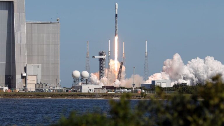
XCUBE-1, a six-unit cubesat that entered orbit in December, is now delivering high-resolution imagery across a wide spectrum of wavelengths, the company announced Tuesday. The satellite captures images with a resolution of 5 meters per pixel, supporting applications in defense, intelligence, agriculture, forestry, and maritime monitoring.
Since launch, Xplore has successfully established an imagery tasking pipeline for its first contracted customer, though the client’s identity remains confidential. The company is now inviting additional partners to request imagery samples to evaluate the data for various programs and projects.
“Our imagery is outperforming expectations,” said Jeff Rich, Xplore founder and CEO. “The exceptional quality we’re seeing is the result of advanced ground calibration of our instruments and a sophisticated data processing pipeline.”
According to Xplore, hyperspectral imaging enables unique insights across a variety of fields:
- Defense and Intelligence: The data can reveal disturbed soil indicating new minefields or detect camouflage, offering valuable tactical advantages.
- Agriculture: Farmers can analyze soil health, moisture levels, nutrient needs, pest activity, and fertilizer runoff in fine detail.
- Forestry and Wildfire Prevention: In collaboration with software partners, Xplore’s data allows accurate identification of tree and crop species, assessment of vegetation health, and detection of fire-prone areas like dense canopies and deadwood.
- Maritime Monitoring: Hyperspectral imaging can identify spectral signatures of individual vessels, aiding in efforts to curb illegal fishing, dumping, trafficking, and other unlawful maritime activities.
Additionally, Xplore is leveraging its satellite capabilities for space domain awareness under a license from the National Oceanic and Atmospheric Administration (NOAA). XCUBE-1 can capture high-resolution images and spectral data of other orbiting objects, supporting the monitoring of potential adversarial satellites. The satellite can also help identify and analyze space debris, such as defunct rocket boosters and fairings, based on material properties.
“There is a growing need to monitor space assets and debris for the U.S. and allied defense communities,” the company noted.
Lisa Rich, Xplore founder and COO, praised the progress: “We’re thrilled with the results and grateful to our talented team and partners. The quality of our imagery reflects their hard work and dedication.”
Looking ahead, Xplore anticipates significant growth in demand for high-quality hyperspectral imagery across multiple sectors as it continues to expand its capabilities and customer base.