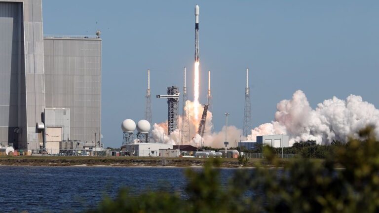
In a landmark moment for international space collaboration, the Indian Space Research Organisation (ISRO) on July 31 2025 successfully launched the NASA-ISRO Synthetic Aperture Radar (NISAR) satellite — the first-ever Earth observation mission jointly developed by India and the United States. The mission was launched at 5:40 PM IST aboard ISRO’s Geosynchronous Satellite Launch Vehicle (GSLV) F-16 from the Satish Dhawan Space Centre (SDSC-SHAR), Sriharikota, marking the 102nd launch from the site.
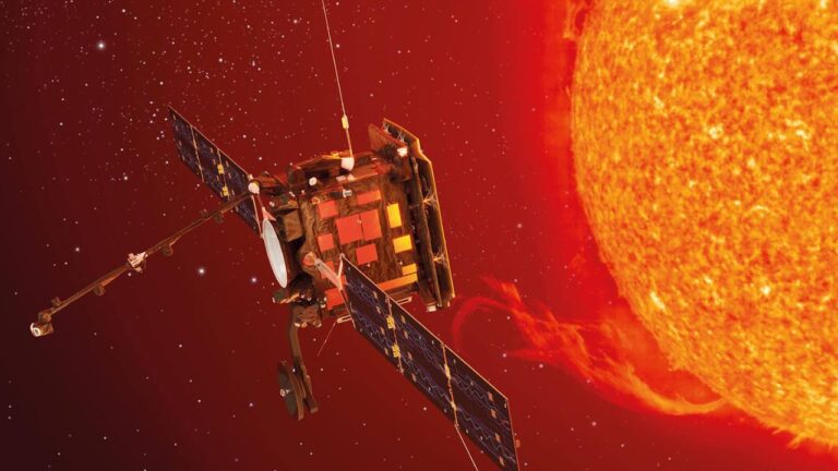
Developed at a cost of $1.5 billion with a planned mission life of five years, the 2,393-kg NISAR satellite carries cutting-edge dual-band Synthetic Aperture Radar (SAR) systems — L-band provided by NASA and S-band developed by ISRO. It will deliver high-resolution, wide-swath images of Earth’s land, ice, and ocean surfaces every 12 days using the advanced SweepSAR technique, a global first in radar satellite technology.
This is the first time that ISRO’s GSLV has placed a satellite in a Sun Synchronous Polar Orbit (SSPO), at an altitude of 747 km, diverging from its traditional geostationary mission profile. The satellite was precisely inserted into orbit just 19 minutes post-lift-off, with ISRO Chairman V. Narayanan confirming a deviation margin of less than 3 km — well within the permissible 20 km.
“Today we achieved the intended orbit with all vehicle systems performing nominally,” said Narayanan. “This marks a pivotal moment in ISRO’s history and our longstanding cooperation with NASA.”
NISAR is poised to revolutionize Earth science by capturing centimeter-level changes in the planet’s surface. The mission’s dual radars will monitor nearly all land and ice-covered surfaces globally, including seldom-observed regions of the polar Southern Hemisphere. Its data will enable enhanced monitoring of natural disasters such as earthquakes, landslides, and volcanic activity, as well as applications in agriculture, infrastructure, and ecosystem conservation.
According to Chaitra Rao, Project Spacecraft Director, the solar panels were deployed successfully post-insertion, and the spacecraft has begun its 90-day commissioning phase. This period will involve extensive checks and calibrations by NASA’s Jet Propulsion Laboratory (JPL) and ISRO, including the deployment of its 12-meter radar reflector antenna.
The S-band radar, data handling, and launch systems were developed by ISRO, while NASA contributed the L-band radar, solid-state recorder, GPS receivers, and the radar reflector boom. The collaborative mission integrates hardware, engineering, and science objectives from both agencies — marking a first in the history of Earth observation missions.
NASA’s Science Mission Directorate Associate Administrator Nicky Fox lauded the achievement, saying, “NISAR’s data will provide life-saving insights to communities around the world. It’s a symbol of the deepening partnership between the U.S. and India.”
The satellite’s operations will be managed jointly, with ISRO’s National Remote Sensing Centre (NRSC) in Hyderabad expected to receive 8 terabytes of data daily, while NASA’s JPL will handle 35 terabytes. Ground stations in Antarctica will also support data reception and dissemination.
“This mission is truly a pathfinder,” said Casey Swails, Deputy Associate Administrator at NASA, “not just for its technical brilliance, but also for setting a precedent in cross-national collaboration.”
With the successful launch of NISAR, ISRO and NASA have opened a new chapter in Earth science, climate research, and disaster preparedness — delivering not just high-quality data, but also a message of shared commitment to understanding and safeguarding our dynamic planet.